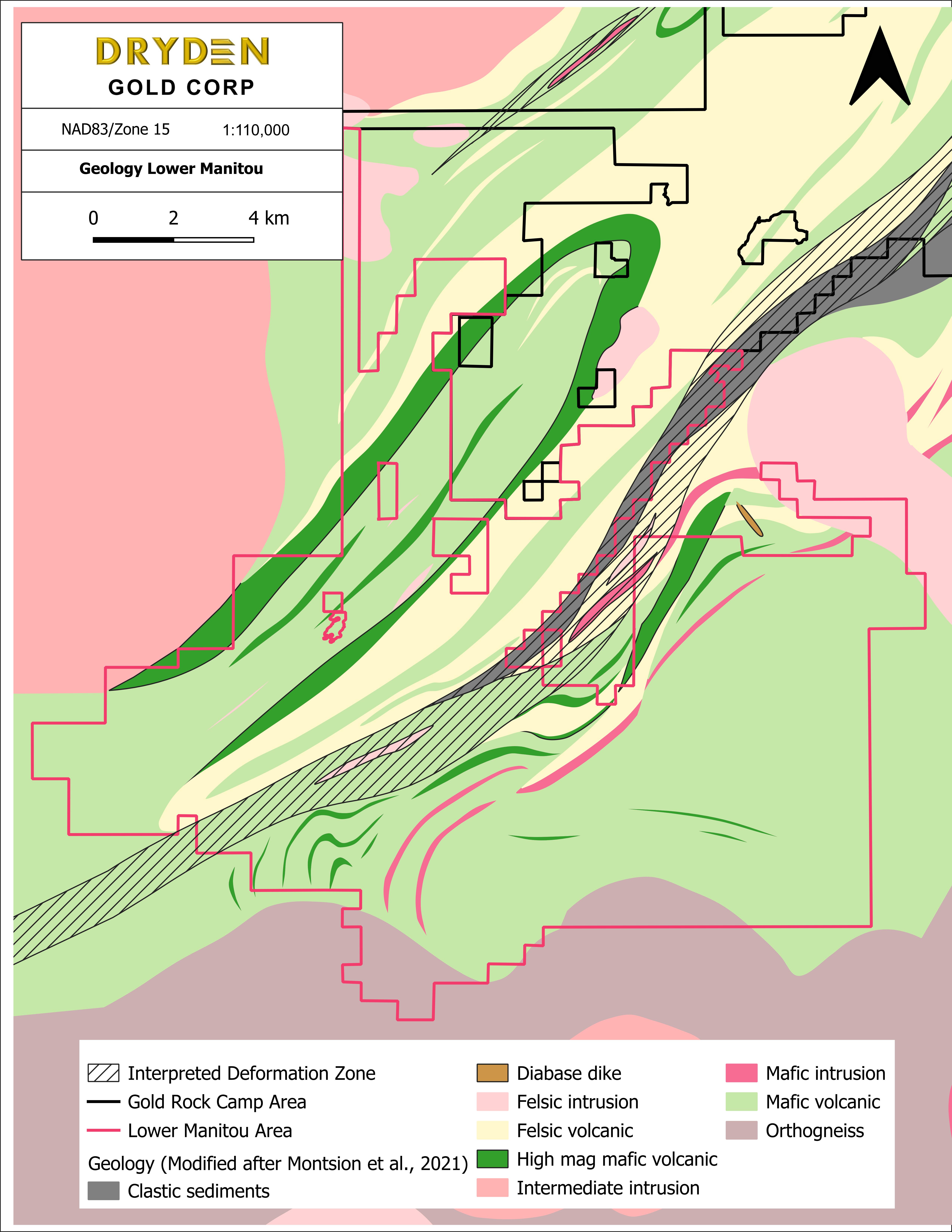
Located at the southern extension of the project, the Lower Manitou area consists of the Gaffney Patents, Gaffney East, Gaffney Extension and Sherridon properties.
Lower Manitou Drill Intercept Highlights: Gaffney – 2.4 g/t Au over 75.1m Gaffney – 5.0 g/t Au over 8.8m Sherridon – 46.0 g/t Au over 0.5m
Mineralized zones are controlled by both competency contrasts during deformation between the quartz diorite and the surrounding volcanic rocks as well as the behavior during deformation of the quartz-diorite itself.
The property hosts high grade gold mineralization on Kenwest, Canamerica Main, Canamerica 502, Gaffney and Sherridon.
Gaffney (Extension and East)
The Gaffney Extension and East are mainly underlain by mafic volcanic and intermediate to felsic volcanic rocks of the Blanchard Lake group and magnetite –bearing quartz- diorite, all of which are intruded by qua1tz-feldspar porphyry dykes. Shearing of the above rocks resulted in iron-carbonate and sulphide-bearing schists.

Gaffney Patents

The Gaffney Patents are located on the eastern shore of Manitou Island on Lower Manitou Lake. The property is characterized by two cross- cutting sets of feldspar porphyry dykes. Gold mineralization is generally confined to a variably altered quartz diorite intrusion as well as within quartz-feldspar porphyry dykes but is also found in intermediate mafic volcanic wall rock.
Sherridon
The Sherridon property is located about 10 km directly southeast of the Gaffney Extension and in close proximity to the MDdz on the west boundary of the claim group.
Work by the OGS has indicated that the majority of Archean lode gold deposits in the Manitou Lakes area are controlled by shear and fracture zones which appear to be regionally related to movement along the MDdz. Mineralization on the property occurs as visible gold in quartz veins in sheared pillow basalt close to the contact of a quartz porphyry sill.


Geology Lower Manitou Area

Gaffney (Extension and East)

Gaffney (Patents)

Sherridon Property Claim Map

Sherridon Geophysics


